Trail Guide
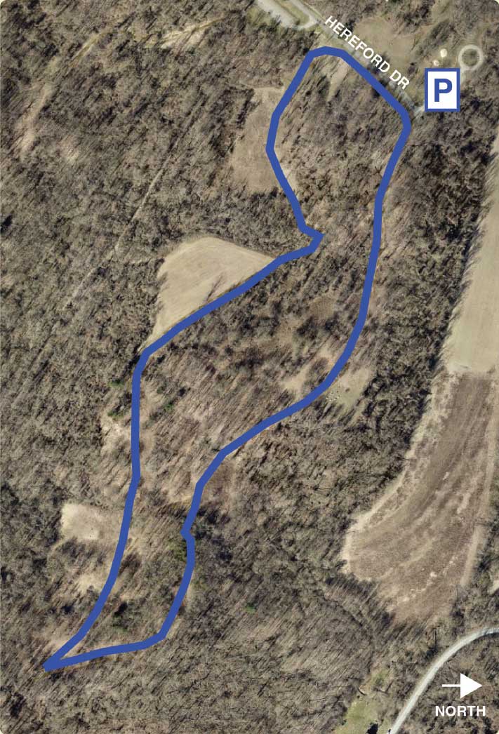
This walk follows part of the same path as the Red Trail but is just over one mile in length and has far less elevation changes. The trailhead is marked by a section of split rail fence with both red and blue blazes. Follow this path through the forest and fields, staying to the left at the first fork as the trail enters a wide clearing with a fire ring used by scouting groups. The trail continues at the far end of the clearing. Stay left and go through a small strip of forest and proceed downhill through another small field. Stay left again and climb up a small knob and through a small pine grove. As you descend the knob, continue following the edge of the wood line, staying to the left. At the other end of the field you will see a marker indicating a sharp turn; the Blue Trail will take you back towards the parking lot while the Red Trail will continue on. You will come to another open field where the trail will “Y” again; stay to the left (right will take you back on the route you just came from.) Follow along a series of fields; some fallow and others may have crops planted depending on the time of the year. The trail will curve through a final section of forest and then open into a final field where you will see the road again. Pass through a restoration tree planting and then meet the road just below the Harmony House Shelter parking lot where you will join the Red Trail again.


Loving this trail?
Download the Allegheny County Parks Trails app from your app store to find this trail on your device. Learn more.
- Discover trails within each Allegheny County park and easily choose which one to traverse by viewing its length, difficulty, and elevation profile.
- Track your location using this GPS-enabled app, and switch among imagery, topographic or terrain basemaps to give you a better sense of your surroundings.
- Get current weather conditions, alerts, and upcoming forecasts from the National Weather Service (NWS).
